Adaptive Location System
Description
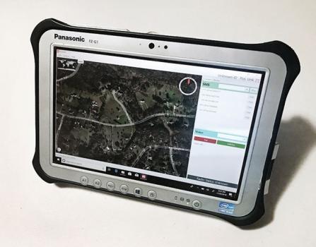
Locorum is a multi-platform application specially designed to use the Iridium global network on tablet and mobile devices. It is the first that puts digital map display, along with voice and text, onto a single application.
Key characteristics of Locorum include:
- Digital Mapping: Using NASA’s World Wind 2D/3-D Geographic Information Systems (GIS), letting users access 140+ mapping and imagery formats. This includes KML, Esri Shape, Electronic Nautical Charts (ENCs) and other georeferenced imagery.
- Iridium: it accesses the Iridium network to provide global coverage – open ocean, desert, frozen wastes – anywhere on Earth.
- Talk to anyone: We can send or receive calls or texts with anyone with a phone number on any network – AT&T, Verizon, etc.
- Internal GPS: Receive, distribute and display GPS locations between Locorum users.
- Peer network: We exchange info with other Locorum users on the Iridium network directly – their location, status, targets, events, etc.